Skip to content
Top Menu
Mon 27th June, 2022
  • About
  • Contact
  • Urban75 main site
  • Urban75 forums
  • BrixtonBuzz

urban75: art, photos, walks

Street photography, photo features, travel, protest, seaside, railways, rainy days, London, NYC, Wales and more

  • Home
  • art
  • Walks
  • London
  • Brixton
  • New York
  • Wales
  • Railways
  • Music
  • Protest

Tag: map

Brixton poverty and wealth map reveals the area's rich and poor divide
Brixton / London / Places

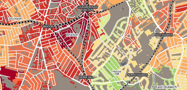
Brixton poverty and wealth map reveals the area’s rich and poor divide

Thu 31st January, 2013Thu 31st January, 2013 - by editor - Leave a Comment

Created in the style of Charles Booth’s landmark Poverty Map, this new map covering the UK  lets you view housing arranged by the Index of Multiple Deprivation or Output Area …

Read More
Did your street get bombed in the war? View Brixton WW2 bombsites on this fascinating website
Brixton / London / Places

Did your street get bombed in the war? View Brixton WW2 bombsites on this fascinating website

Wed 5th December, 2012Wed 5th December, 2012 - by editor - 4 Comments.

A new project called Bomb Sight has produced an interactive website that maps the London WW2 bomb census data recorded between 7/10/1940 and 06/06/1941 – and it’s clear that Brixton took a bit of …

Read More
Brixton / London / Places

Brixton ranks low on London life expectancy rates

Tue 24th July, 2012 - by editor - 2 Comments.

This intriguing map uses a novel way to highlight London’s social inequalities, demonstrating how where you live can have a dramatic impact on your life expectancy rates.

Read More
London / Places / railways

Fantastic London transport map is a rail buff’s delight

Tue 22nd March, 2011Mon 21st March, 2011 - by editor - 7 Comments.

If you’re as cartographically obsessed as me, you’ll quite happily spend long hours poring over Ordnance Survey maps, archive maps, route diagrams and rail maps, and if you’ve any interest …

Read More
London / Places

London’s most common surnames listed by area and origin in a natty map

Wed 26th January, 2011Wed 26th January, 2011 - by editor - 1 Comment

Data-chewing whizzkid James Cheshire has imbibed a ton of facts from the 2001 electoral register to create an interactive map showing off the most common surnames in London by area.

Read More

Instagram

Cat and boots #drmartens #ziggy
#rootedbeings at the #wellcomecollection #london
Flight by #davidbruerweil at the #stpancraschurch #eustonroad
A walk through #hollandpark #kensington
Superb #football #design #exhibition at the #designmuseum
#brighton at night

Recent posts

  • In photos: Worcester’s one-man Cathedral Ferry service across the River Severn
  • The beautiful, Grade II listed countryside Church of St Guthlac in Little Cowarne, Herefordshire – in photos
  • In photos: Victorian semaphore signals still in use at Worcester Shrub Hill railway station
  • Glasgow and Edinburgh photos: architecture, steps, skylines, street art and the penis steps
  • In photos – Football: Designing the Beautiful Game at the Design Museum, London

Recent comments

  • Margaret on Brixton Roller Skating Rink – memories from the late 1950s
  • Les Adams on Brixton Roller Skating Rink – memories from the late 1950s
  • Sheila McCluskey-Carroll on Lost streets of Brixton: Geneva Road, SW9
  • Jenny on Lost streets of Brixton: Geneva Road, SW9
  • Lyn Smith on London’s coffee bars in the 1950s and 1960s – archive video footage

Twitter

My Tweets

Archives

Meta

  • Log in
  • Entries feed
  • Comments feed
  • WordPress.org
All content ©urban75
 

Loading Comments...