A day trip to Dover, Kent
An autumnal visit to the south-east of England
Photos and report © urban75, Oct 2006
A major channel port near the south-eastern tip of England, the Kentish town of Dover has a population of around 28,000 inhabitants (census: 2001).
Its famous white cliffs gave Britain its nickname of Albion (and a bloody awful Vera Lynn song), which means 'white,' while the town's name derives from the Brythonic word, 'Dubra-s,' meaning, 'the waters.
On account of its closeness to continental Europe - the French port of Calais is just 34 kilometres (21 miles) away - Dover has developed into one of the UK's busiest cross-Channel ports, with some 18 million passengers passing through every year.
An important port for millennia, Dover's history goes back to (at least) the Bronze Age, while in Roman times it served as the fortified port known as Portus Dubris.
During the 19th century, the population soared by 600 percent as the railways brought tourists and cross-channel traffic, while
Dover became the centre of the English Channel defence during World War I.
Along with nearby Folkestone, Dover was one of the main troop embarkation ports for France in WW1 and suffered shelling airplanes, Zeppelins and passing warships throughout the war.
Things were even worse in WWII, with a complex of underground caves and tunnels being dug out of the cliffs to be used as air-raid shelters and a military base.
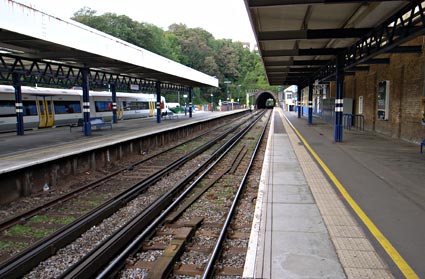
Dover Priory railway station, reachable by trains from London Charing Cross via Tonbridge, London Victoria via Canterbury East and Chatham and Ramsgate via Deal.
Now the sole station in the town, Dover was formerly also served by Dover Town (1844-1914), Dover Marine/Dover Western Docks (1909-1994) and Dover Harbour (1861-1927).
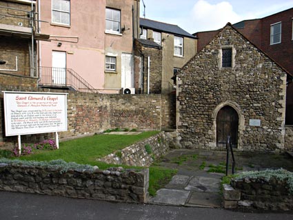
Saint Edmund's Chapel. Consecrated by St Richard of Chichester in March, 1253, it is the only chapel ever dedicated by an English saint to the honour of an English saint.
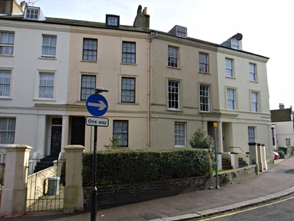
Elegant Georgian terraced houses in Effingham Crescent, close to Dover Priory.
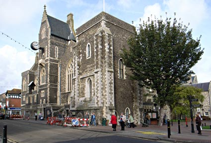
Dating back to 1203, The Hospital of St Mary, Domus Dei, or Maison Dieu, is part of the Old Town Hall buildings, and was originally constructed to accommodate pilgrims coming from the Continent to visit the shrine of Thomas � Becket in Canterbury.
The building was extended over the years before being sold to Corporation of Dover in 1834, who converted it into their new Town Hall.
It is now used for conferences, weddings, banquets, fairs, concerts and theatrical performances.
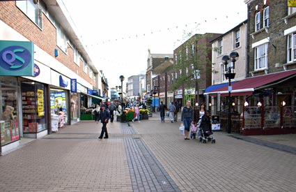
A vista of the rather characterless main shopping thoroughfare, Biggin Street.
For hundreds of years, this was the main road out of the town to Canterbury and London.

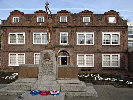
Dover Town Council with war memorial in the foreground.
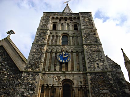
Possibly built on the site of an earlier Saxon structure, parts of the St Mary the Virgin church date from the 11th century, and it is assumed to be one of the three Dover churches listed in the 1086 Domesday Book.

A view of the small graveyard by the church.
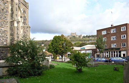
Dover Castle in the distance seen from the back of St Mary the Virgin church.
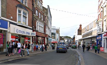
Another view of the disappointingly bland and now pedestrianised Biggin Street.
A traffic census in the last week of May 1893 revealed a bustling Victorian thoroughfare, with 9,440 ordinary light and heavy vehicles, 908 cycles and bath chairs and 446 horses recorded.
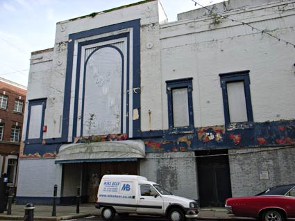
The crumbling remains of Snoops nightclub on Dover's Castle Street.
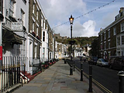
The attractive Georgian architecture in Castle Street.
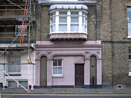
Striking house on Frith Road.
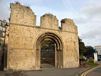
The remains of St James's Church, a Saxon church rebuilt in the 12th century.
The church was also used as a meeting place of the official courts of the Barons of the Cinque Ports, with the last meeting in 1851 being presided over by the Duke of Wellington.
The church was hit several times by enemy bombs during World War 2, with the tower eventually collapsing.
After the war, it was decided to leave the church in its ruined state to commemorate the suffering of the people of Dover during the war.
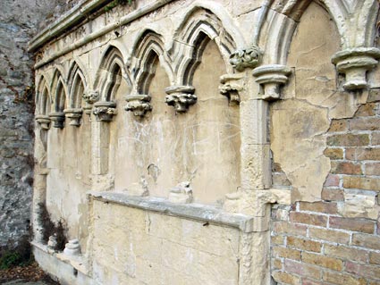
Another view of the roofless church.
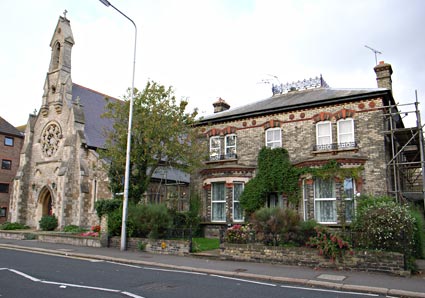
St Paul's Catholic church and adjacent solid Victorian house, Maison Dieu Road,. The church was designed by E.W. Pugin (1867).
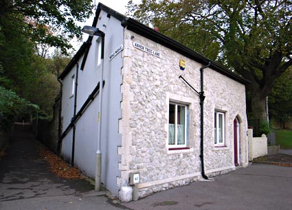
Corner building, Ashen Tree Lane and Harold Passage.
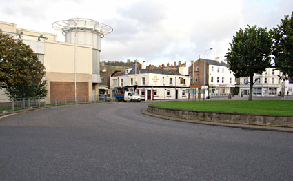
Don't you just want to track down the moronic planner that decided to shove a dirty great roundabout in the middle of town and give him a well deserved slap in the mush with a wet fish?
This ghastly carbuncle puts cars above every other living species, and forces pedestrians to walk all the way around it just to get to the railway station - and that hideous new development to the left looks like it's fallen straight off the ugly tree.
|
|