urban75 walk club: Brighton and Devil's Dyke (part two)
Report and pics © urban75 editor, May 2005
Part two: a picnic in Devil's Dyke, some dodgy folk tales, a ton of facts and a pub-laden stroll through Poynings and Fulking, West Sussex.
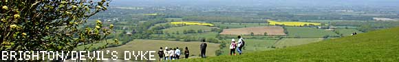
Devil's Dyke
Devils Dyke is is the deepest dry valley in the world and covers some 200 acres of downland scarp, situated in a deep, dry valley.
The Dyke's unique features were created after the last Ice Age, when melting water eroded the chalk downland to the permafrost layer. After the ground thawed, the water flowed straight through the chalk, leaving the dry valley we see today.
In Victorian times the place was awash with tourists, drawn in by a host of attractions incuding two bandstands, an observatory, a camera obscura, fairground rides, a switchback railway and an aerial cableway railway across the combe (the first in Britain).
Designed by William Brewer, the cable railway was constructed in 1894 and consisted of 1,200 feet of cable suspended 230 feet above the valley floor on cast metal supports.
Starting operation on 13th October 1894, two cars, carrying four passengers each, were propelled across the valley by a cable worked by an oil engine. We would have fancied a go on that ourselves but, sadly, the operation ceased sometime around 1909.
The area also boasted the Devils Dyke Railway, a twin-track 840 ft-long funicular railway, that took passengers up and down a 1:1.5 incline from Devils Dyke towards Poynings. Opened in July 1897, passengers failed to materialise, and the venture was abandoned after 11 years.
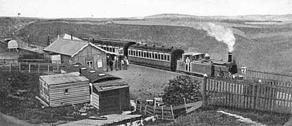
Dyke Station railway station, circa 1905
During the August bank holiday in 1893, an amazing 30,000 people flocked to Devil's Dyke, many of them brought up by a special railway line running from nearby Brighton.
The line opened on the 30th September 1887, climbing on an almost continuous gradient of 1 in 40 to a point 200ft below the summit leaving visitors with a hefty half mile climb to the top.
With increasing competition from motor buses, the branch closed on 31st December 1938.
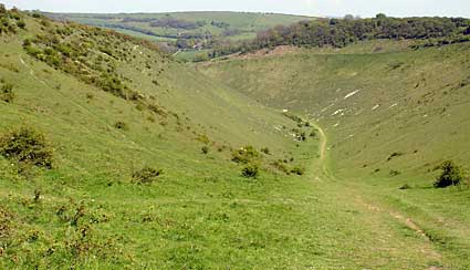
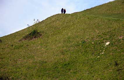
Descending into Devil's Dyke
Folklore says that Devil's Dyke got its name when the Devil got seriously miffed at the conversion of Sussex - one of the last counties to give up Paganism - and was deeply unchuffed at the way churches were being springing up in every Sussex village.
To teach those pesky Christians a lesson, he decided to dig right through the South Downs to let the sea flood Sussex in a single night and drown the new Converts.
Starting inland near the village of Poynings, the Devil attacked his task with gusto, sending huge clods of earth all over the shop.
Credibility-stretching legend has it that these excavated piles of earth became Chanctonbury hill, Cissbury hill, Rackham Hill and Mount Caburn.

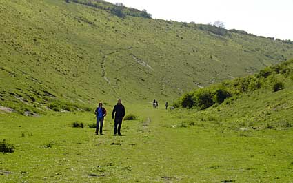
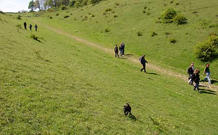
Walking Devil's Dyke
Trouble was, the Devil's digging was making such a racket that he disturbed an old woman, who, upon realising that the Devil was being a very, very naughty boy, held up a candle behind a sieve and knocked a cockerel off his perch.
The dim Devil heard the cockerel crowing, saw the light which he mistook for the sun rising, and fled the scene before he could finish the job.
Some say that as he fled out over the English Channel towards Johnny Foreigner-land, a great lump of earth fell from his cloven hoof, which became the Isle of Wight. Others suggest that he trotted northwards into Surrey, where his heavy landing formed the hollow called the Devil's Punch Bowl.
Others may, of course, say that the whole thing is a load of old bollocks.
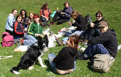
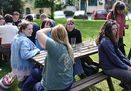
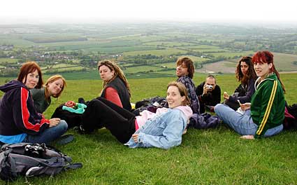
Picnic at Devil's Dyke
We enjoyed a fabulous picnic half way along Devil's Dyke. Everyone had brought so much food, we were in danger of being too stuffed to walk any further!
Special credit must go to Stig's freshly-baked home made bread which was delicious!
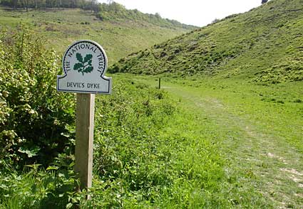
Leaving Devil's Dyke
There's two ancient earthworks at the northern entrance to the dyke, known locally as the Devil's Grave and the Devil's wife's Grave.
More daft folklore has it that the Devil was buried there after the fake light caused him to perish and if you run around the Devil's Grave seven times holding your breath, the Devil will appear.
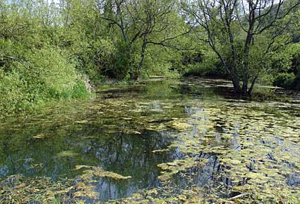
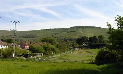
Pond by Poynings
The walk took us past this attractive pond on our way to the small village of Poynings.
Drinking at the Royal Oak, The Street, Poynings
We stopped off for a lovely pint of Harveys Sussex Ale at this busy village bar with a large beer garden.
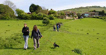
On the way to Fulking
Leaving Poyners behind, we headed off across open fields towards a village with the schoolboy joke-attracting name of Fulking.
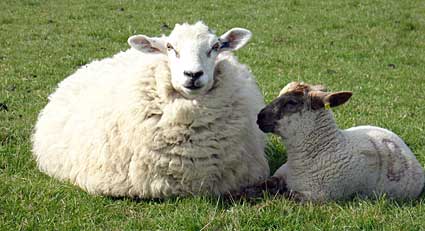
Sheep and lamb
We had to cross a field full of sheep giving it lots of "Baaa!" action.
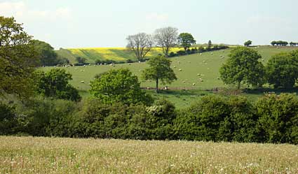
Countryside view
The walk took us through some delightful countryside.
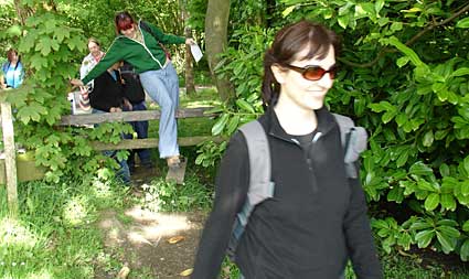
Style jumping
Athletic style-leaping motion from our guide. Note the fact-packed information sheet in her hand.
South Downs view
Looking south with the Downs on the horizon.
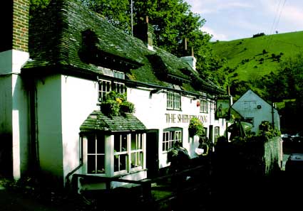
Shepherd and Dog, Fulking
We liked this traditional pub, tucked under the escarpment of the South Downs, and grabbed a couple of pints to prepare ourselves for the forthcoming hill climbing.
I enjoyed the Badger's Fursty Ferret ale, described as a "well balanced, crisp premium ale with a malty palate and noticeable hoppy aroma" (4.4% ABV).
Why the daft name? I'll let the Badger Brewery website explain:
"When in decades past the idyllic country home of Miss Rose Gribble became a local inn, legend has it that the inquisitive local ferrets frequented the pub's back door on a mission to sample its own reputed brew. In their honour it was named Fursty Ferret, and today is brewed in greater quantity, so now you can enjoy the celebrated ale that still eludes the ferrets of the Gribble Inn."
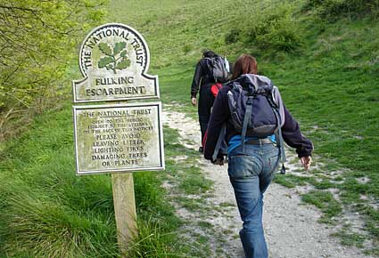
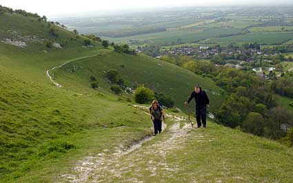
Walking up the Fulking Escarpment
It's a fair hike up the Fulking Escarpment and not recommended straight after a session in the pub.
Stig and William, Fulking Escarpment
Probably driven by a desperate need to get to the next pub, two of our party accelerated ahead of the pack while I went back to locate some lost walkers.
Up the Fulking Escarpment
The walk up the escarpment isn't as tough as it looks from the bottom, and the views are truly spectacular.
Fulking Escarpment is part of the Site of Special Scientific Interest that runs from Beeding Hill to Offham, and supports some of the finest downland flora and fauna anywhere in the South Downs.
The Escarpment is owned by the National Trust, and people are free to roam anywhere on the estate.
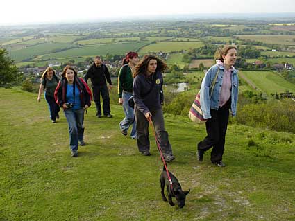
Near the top
Our group of finely tuned athletes race up the hill with ease.
Well, sort of.
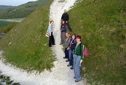
Group pose, Fulking Escarpment
With a refreshing pint of beer only minutes away, the walkers pose for a photo.
End of the walk, Devil's Dyke
With a truly breathtaking Sussex vista as a backdrop, we relaxed with another picnic and yet more ale outside the Devil's Dyke pub.
Big up to Eme for organising such a fantastic day out!
|